HOYRAN WEDRE SURROUNDINGS
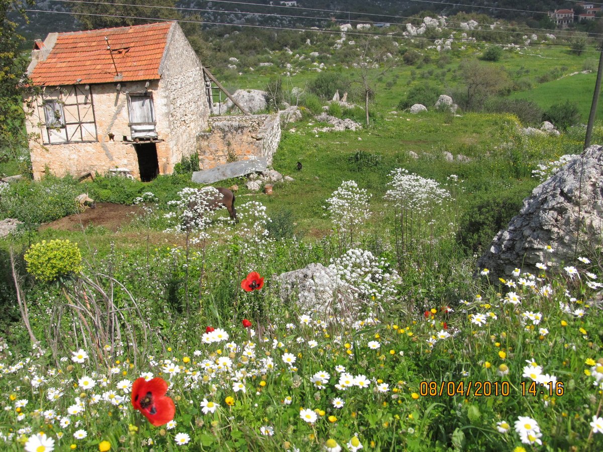
Hoyran Wedre is situated in a picturesque valley overlooking the turquoise waters of the Mediterranean. The idyllic village setting hosts an ancient Lycian city protruding from the lush vegetation. The Lycians were a sea faring nation and a fiercely independent people setting in the area from circa 1300BC. As one of the oldest civilizations in Anatolia the Lycian warriors fought on the sea of the Trojans in Homer’s classics battle for Troy.
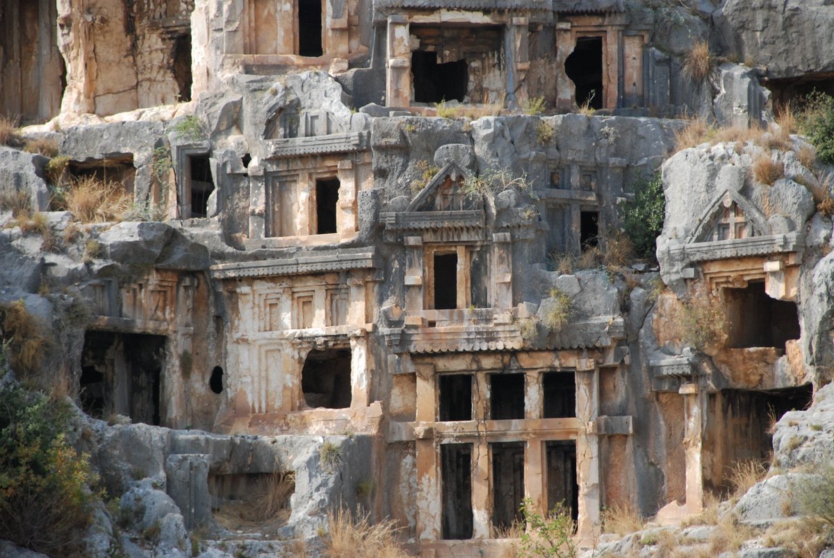
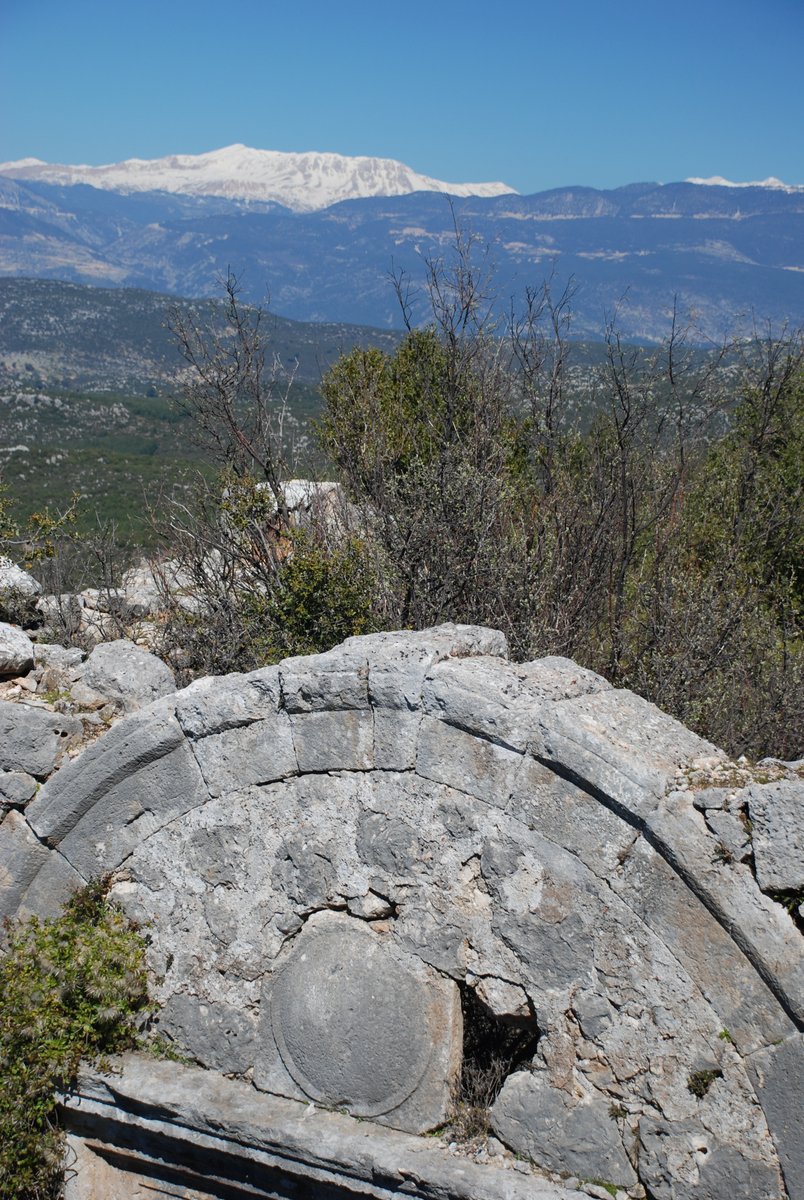
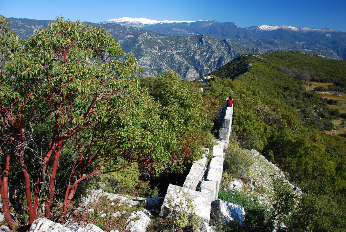
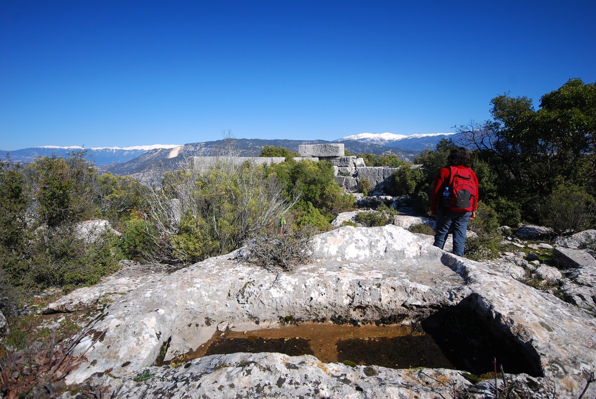
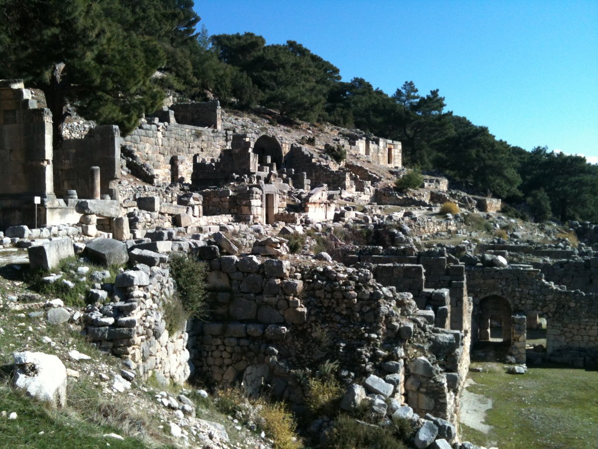
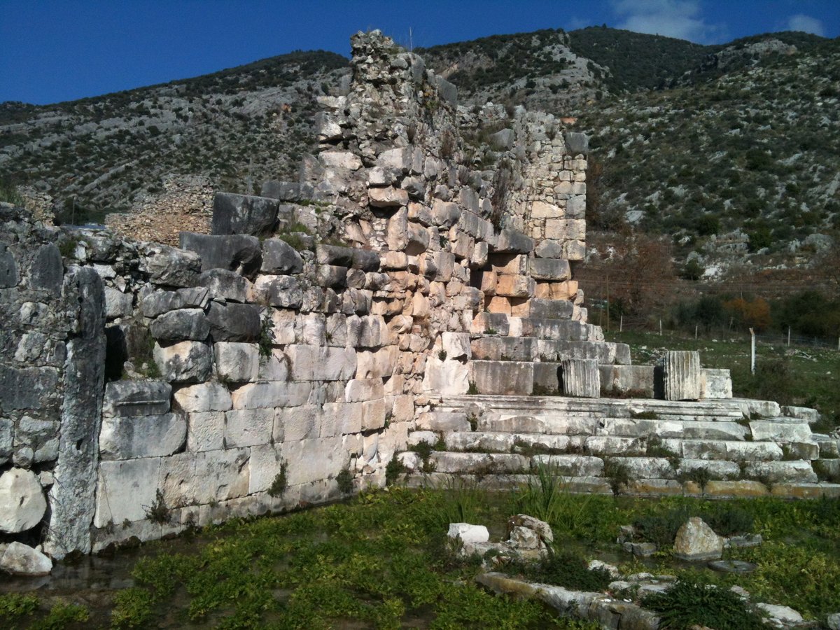
Hoyran Wedre translates to “land of the goddess” and a tour through the ruins certainly lives up to the name. After passing the traditional stone houses and almond groves, one leaves the village behind to cross stone wall terraces of cultivated land. A Lycian “house type” tomb chiselled out of the cliff face protects the entrance to the sight, as the path rises on worn steps cut into the rock. Aromas of sage, oregano and bay fill the air as one brushes past the greenery set in the rugged terrain. The path winds up the hillside past numerous sarcophagi (tombs) with gothic style lids entering a small valley and the cities necropolis. In early spring the valley is filled with a carpet of crown daisies dotted with splashes of colour from other wild flowers.

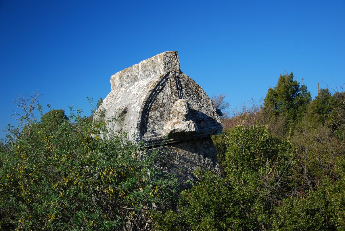
A pillar tomb with a warrior relief mark the way as the path sneaks back into the greenery. Hidden behind are two sculptured rock tombs, one boasting a frieze of family union intricately carved on a side wall. The other has cockerels, partridges and griffons decorating the front facade. A stone slab door sealed the entrance to benches where bodies were laid and treasures were stowed for journey to the “afterlife”. The prominent position of all the tombs show the importance of worshipping the dead with niches cut for ceremonial offerings.
Beyond the tomb lies a secret passage through the rock and descending to a buttressed terrace for one of the most spectacular views along the Turkish coastline. Below lies Kekova island with its sunken port and ancient sites of Simena, Theimussa, Istlada and Andriake can be viewed from this magical spot. The acropolis is placed below the ridge with defensive and supporting walls dividing the hillside. From the ridge the snow capped peaks of the western Taurus are viewed forming the barrier to the interior of the Anatolian plain. From these rocky outcrops signals could be sent as lines of communication to neighbouring cities to warn of advancing armies…
Birds of prey soar high on the uplift from our vantage point and an ancient mule path zigzags down the mountainside connecting to the ports of Kekova. Another walk crosses the hinterland through fertile valleys to the hilltop citadel of Kyaneai. The peace and the tranquillity of the area is to be enjoyed by all in the beautiful natural surrounds which stand frozen in time.
Myra Region
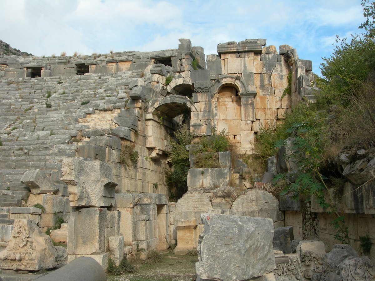
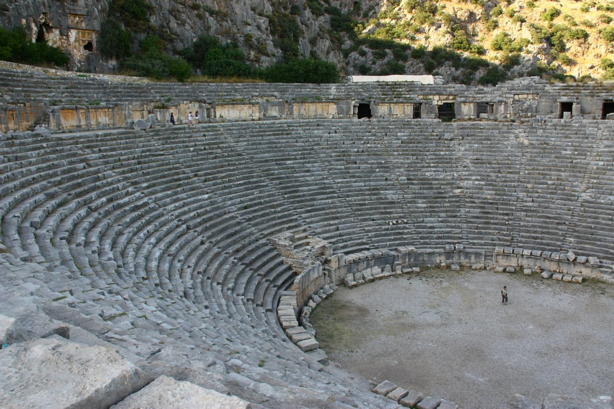
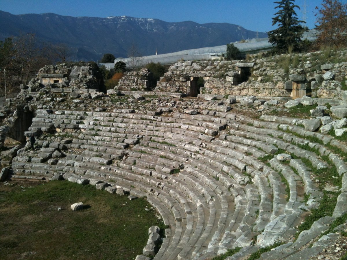
Myra was a leading city of the Lycian Union and surpassed Xanthos in early Byzantine times to become the capital city of Lycia. Its remains are situated about 1.5 km north of today’s Demre, on the Kaş-Finike road. Most of the ancient city is now covered by Demre and alluvial silts, for it is located on the river Demre Cay in a fertile alluvial plain. Today this large plain is almost covered with greenhouses stuffed full of tomatoes. In ancient times this area was probably farmed extensively, for export and trade with the interior of Lycia.
For more information please visit the website: http://www.lycianturkey.com/lycian_sites/myra.htm
St. Nicholas
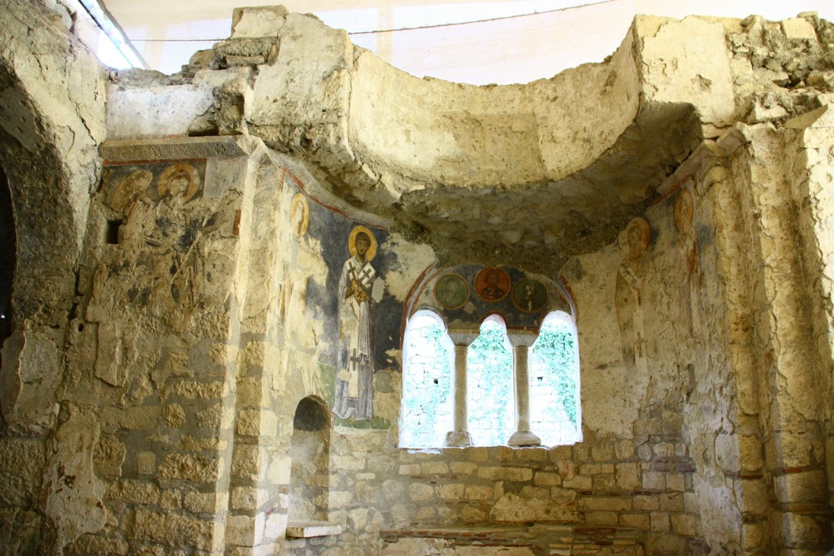
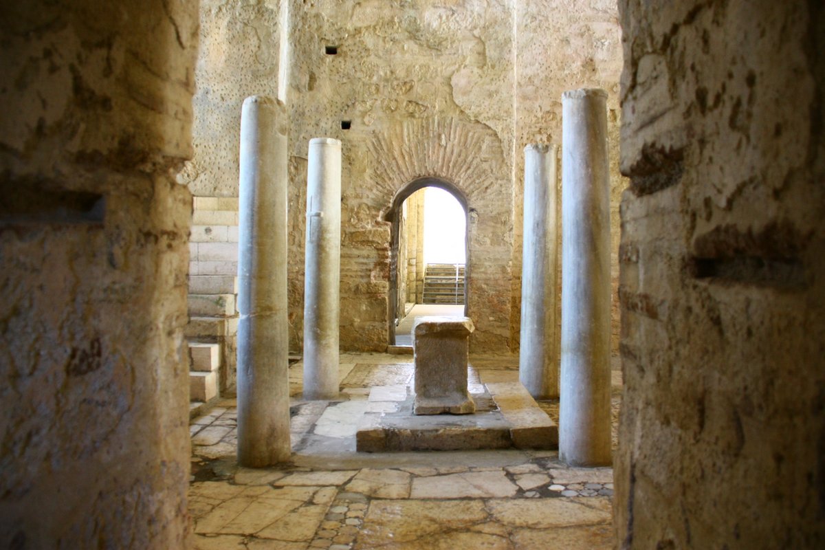
The Church of St. Nicholas in ancient Myra (modern Kale or Demre) is a ruined Byzantine church containing the tomb of St. Nicholas of Myra (the inspiration for Santa Claus), as well as many fine mosaics and murals.
History
St. Nicholas was born in Patara around 300, became bishop of Myra, and died around 350. Only these basic details are known to history, but legends abound concerning the life of the saint. A much-embellished hagiography (life of the saint) was written by Simon Metaphrastes in the 10th century.
St. Nicholas is said to have been born of wealthy parents and to have traveled to the Holy Land in his youth. He was tortured and imprisoned during the persecutions of Diocletian, and released when Constantine ordered official toleration of Christians. Nicholas is said to have attended the famous Council of Nicea in 325 (although his name does not appear in the official lists), where he became so infuriated by the heretic Arius that he slapped him hard in the face!
For more information please visit the website: http://www.sacred-destinations.com/turkey/kale-church-of-st-nicholas-myra.htm

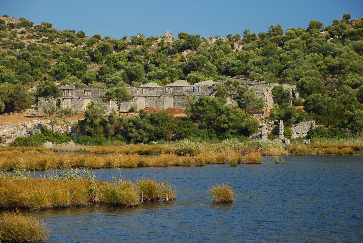
Andriake
Known as the port of Myra, Andriace is in Cayagzi, which is a five-minute drive from the Finike-Kas Road via Sapag (past the Demre exit), by continuing for a few kilometers later after the harbor.
Although described as the port of Myra, Water canal Andriace was actually founded as a sister-town. Churches and the Necropolis around the same time as Myra, it was taken in 197 by the fleet of Antiochus III along with the ancient harbor of Andriace. Emperor Trajan had plans to develop Myra as a port after visiting the area, but this plan did not become a reality until Hadrian was in power.
For more information please visit the website: https://www.exploreturkey.com/exptur.php?id=216

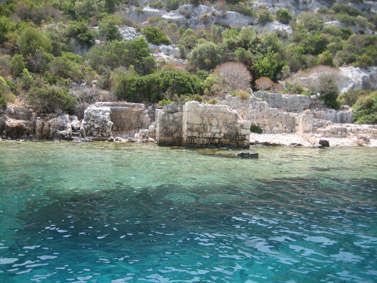
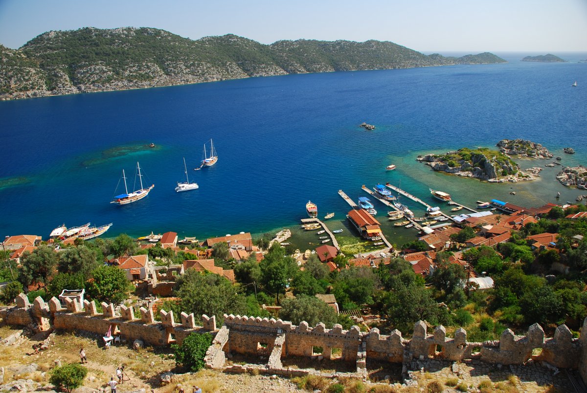
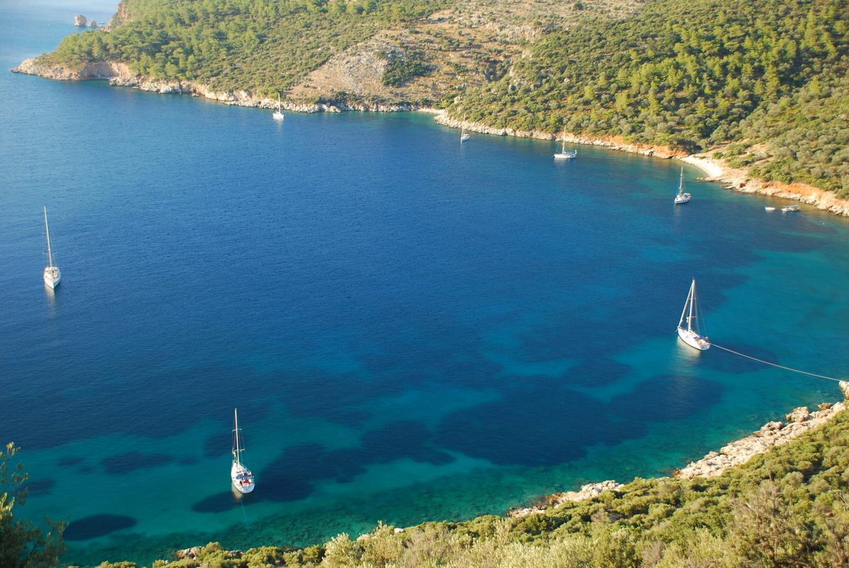
Kekova-Simena Region
Simena is a popular Lycian site, situated upon one of the most attractive spots of the Turkish coast. The name “Kekova” is Turkish for “plain of thyme” and describes the region encompassing the island of Kekova, the villages of Kaleköy and Üçağiz and the three ancient towns of Simena, Teimussa and Tersane (meaning “shipyard”, as its bay was the site of an ancient shipyard, with mostly Byzantine ruins). Both Simena and Teimussa have a large necropolis. Teimussa is now the village of Üçağiz, where boats set off for tours of the area.
For more information please visit the website: http://www.lycianturkey.com/lycian_sites/kekova_simena.htm

Kyaneai Region
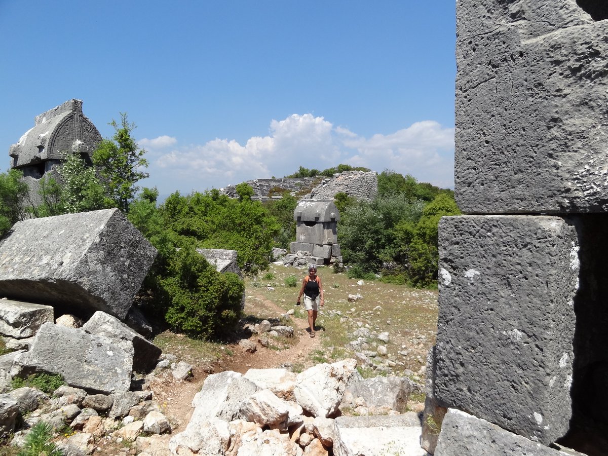
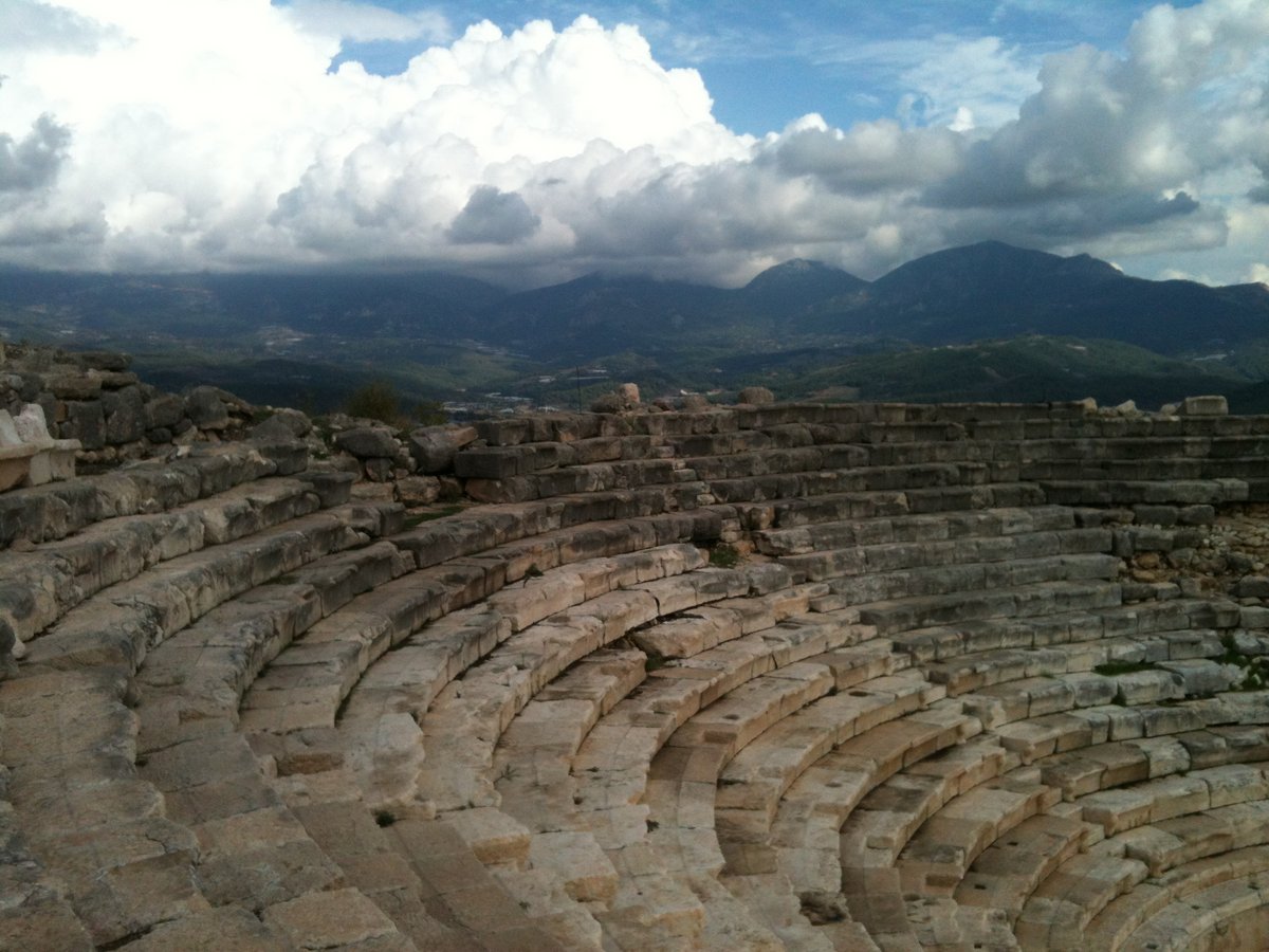
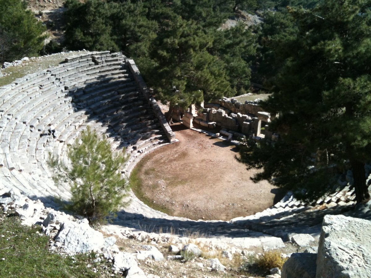
Cyaneae is a Greek name meaning “dark blue” and also “clashing rocks”, though nobody knows why it was so named or which meaning it is supposed to have. Cyaneae is famous for its many sarcophagi which surround the site. There may be over 300 of them and this place has the most sarcophagi of any Lycian site.
Cyaneae is situated on a plateau with a rocky slope to the north descending very steeply to the plain of Yavu below. Two chipped stone axes have been found on the site, but it was probably not continously inhabited until the 5th century BC and was perhaps part of a group of Dynasts’ residences in the Yavu mountain region during that time. In the fourth century BC, during the Early Hellenistic period, Cyaneae became the center of the polis territory. It seems to have been one of Lycia’s important cities, given its strategic location and its large settlement area. An ancient road leads directly to the harbour of Teimiussa. However, though it is listed by many ancient geographers, they give no information about it. Cayaneae reached its greatest point during the Late Roman and Byzantine periods. Reconstruction work was done and many new buildings were constructed (mainly churches). The city walls were also slightly extended and some earlier stuctures had to be destroyed, but some were incorportated right into the walls, such as free-standing tombs and sarcophagi. Cyaneae was abandoned in the 14th century AD, it is thought due to the pressure of the advancing Seljuks.
For more information please visit the website: http://www.lycianturkey.com/lycian_sites/cyaneae.htm

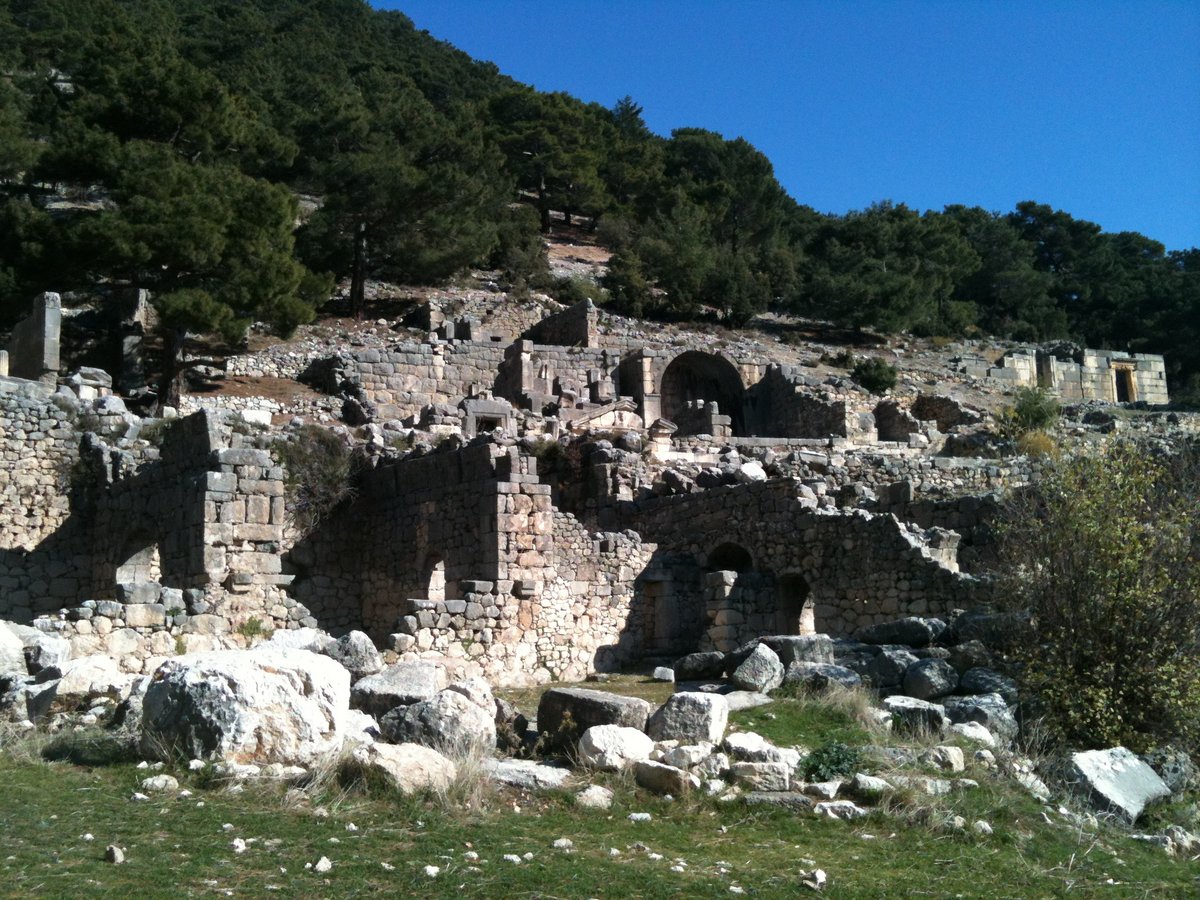
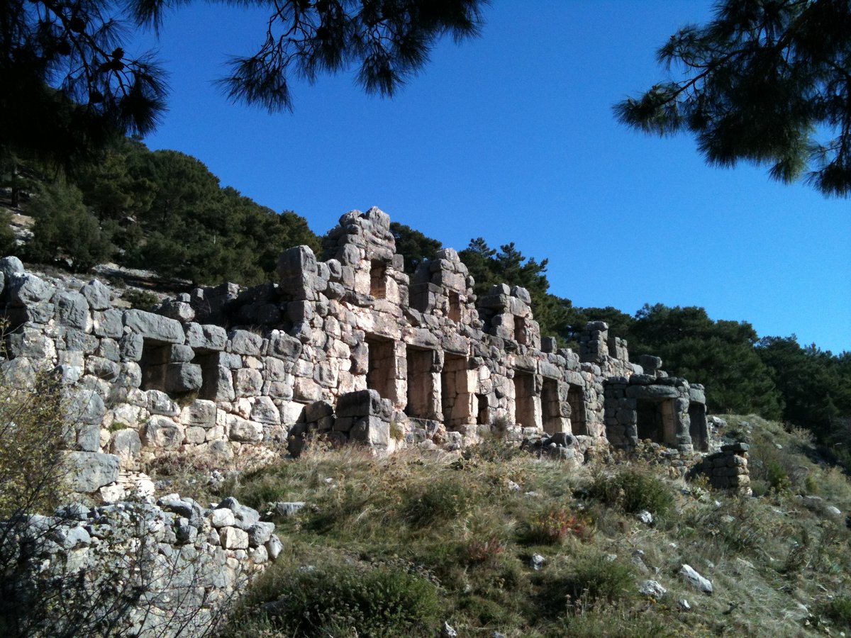
Trysa
This site is remote and not easily accessible; it lies on a crest in the eastern part of the plateau near the village of Golbasi about six kilometers north-east of Cyaenai. Some of its monuments are among the earliest in Lycia.
The discovery of Trysa, and in particular of its remarkable heroum, was among the most exciting events in Lycian archaeology. For the present-day traveler, the site has lost much of its interest: principal sculptures have been carried off to Vienna, but it still has quite a lot to offer. Trysa i mentioned anywhere in ancient literature; the na known only from the inscriptions. Coins of League type inscribed ‘TR’ may well be of Trysa alternative is Trebenna, away in the northeast corner of Lycia.
For more information please visit the website: http://www.exploreturkey.com/exptur.phtml?id=213
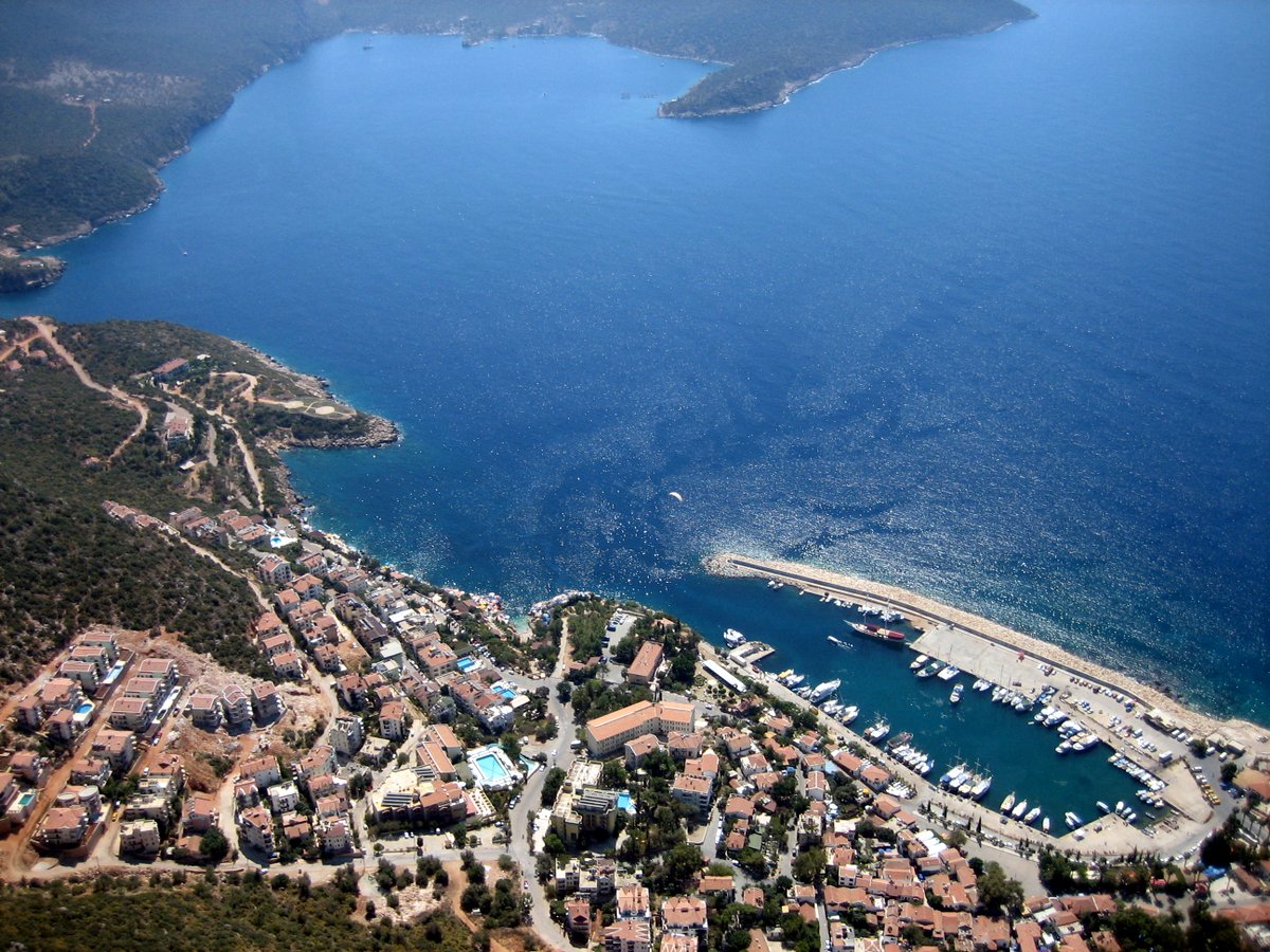
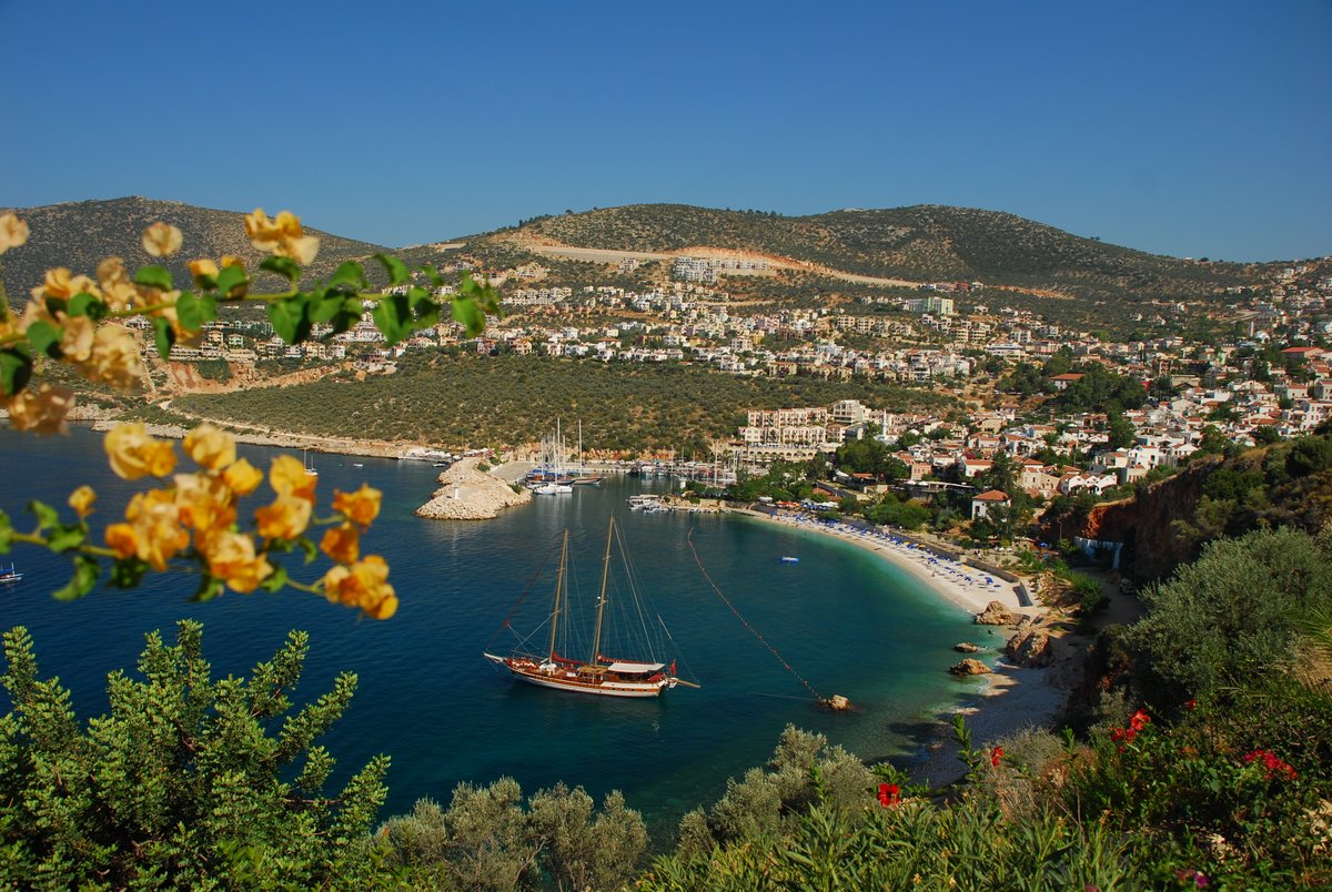
Kas
Kas was one of the most important cities of Lycia, and is now a small resort with great historical interest. Its quaint town centre has a rocky waterfront, with good beaches nearby. There are watersports available in the area, like canoeing,jet-skiing, diving and paragliding, plus cavern diving, which uses technical equipment to explore the deep and dark caverns. For those who love travelling on the water, the Mavi Yolculuk (Blue Voyage) tours, and other excursions on boats, can be madeto the surrounding islands.
History
Habesos is the earliest known name of the ancient city, as proved from archaeological findings. But the name Antiphellos is far more familiar, and this was the harbour of ancient Phellos. Excavations here have revealed a settlement dating back to the4th century BC, possibly earlier, although it reached its height of importance during the Roman and Byzantine periods, when it was a centre for Bishops. It had also been significant in the world of sea-faring commerce, and during the Roman era wasespecially famous for its exported sponges. It was attacked by Arabs, then added to the territory of the Anatolian Seljuks, and took the name Andifli. After the destruction of the Anatolian Seljuk state, the Ottomans added it to its lands. The name Kas means ‘eyebrow’, or ‘something curved’, describing the shape of the town under the backdrop of 500m high cliffs behind.
Kalkan
Kalkan does not seem to have been a place of settlement in antiquity (then known as Phoenicus), though it was the place of the only safe harbour between Kaş and Fethiye and would have offered safety to ships during rough weather. Indeed, a fierce battle was once fought in the bay after Roman and Rhodian ships, unable to attack the neighbouring Lycian port of Patara due to bad weather, found short-lived safety in Kalkan’s bay. Today’s ships still find safe harbour in Kalkan when the seas are rough.
The Lycian coast was famous for its piracy and Kalkan bay no doubt provided a convenient hiding place for pirates to suddenly pounce upon the many heavily-laden merchant ships sailing by.
For more information please visit the website: https://kalkanturkey.com/historic_kalkan/

Patara Region
Patara was the major naval and trading port of Lycia, located at the mouth of the Xanthos River, until it silted up and turned into a malaria-plagued marsh. It is not far from the sites of Letoon and Xanthos and a day trip from Kalkan, Kaş or Fethiye could easily combine the sites. Beautiful 12 km-long Patara Beach, voted one of the top beaches in the world by Times Online – Best of 2005, is an easy 10-15 minute stroll away from the major ruins at Patara. The Patara area is a national park, a key biodiversity area and is rich in birdlife. List of birds spotted in Patara: http://www.birdtours.co.uk/tripreports/turkey/turkey3/index.htm
For more information please visit the website: http://www.lycianturkey.com/lycian_sites/patara.htm


Arycanda Region
Arycanda (Arykanda) is a unique Lycian city, built upon five large terraces ascending a mountain slope, and was known for having the most pleasure and entertainment-loving (and debt-ridden) citizens. The city overlooks a magnificent valley and its view makes it one of the most spectacular sites in Lycia. Located near the small village of Aykiriçay, on the Elmali-Finike road.
Arycanda is known to be one of the oldest Lycian sites – its name ends with -anda, indicitive of its Anatolian origin dating back as far as the second millennium BC. Some of the oldest coins of Lycia (5th c. BC were also found here during a recent digging; the site is under continuous excavation.
For more information please visit the website: http://www.lycianturkey.com/lycian_sites/arycanda.htm
Limyra
Finike is a picturesque coastal town and port to the west of Olympos which is surrounded by citrus orchards and gardens, and is well worth a visit. It has a sandy beach to the east and rocky bays and coves to the west.
A few kilometres from modern day Finike is the ancient Lycian city of Limyra. The history of Limyra, on the Limyrus River, is thought to date back to the Hittite period, although archaeological excavations in the 1960′s failed to prove this conclusively. Most of the ancient remains in the area are from the Lycian and Roman imperial eras, two period which overlapped to a large extent all over Lycia.

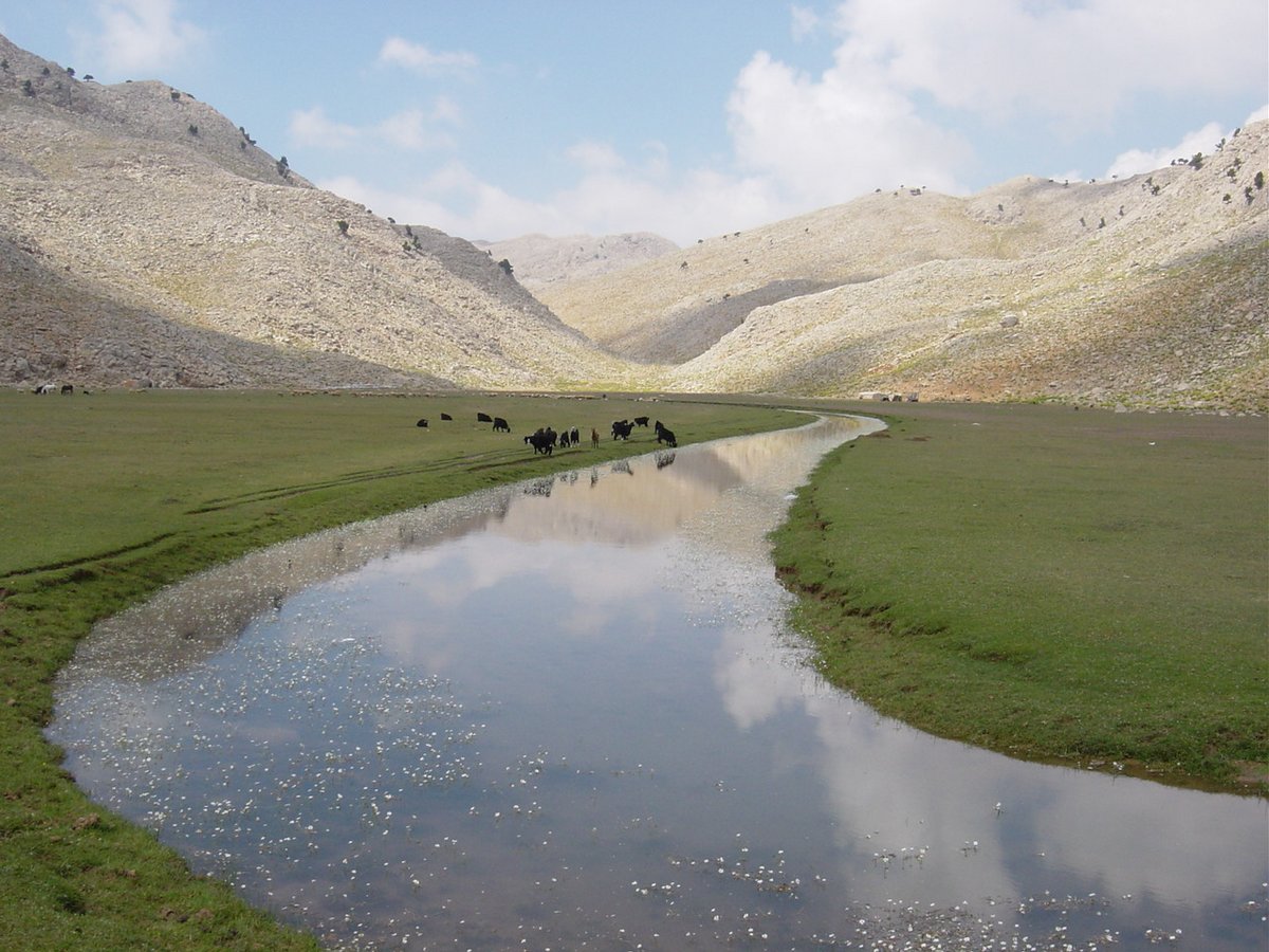
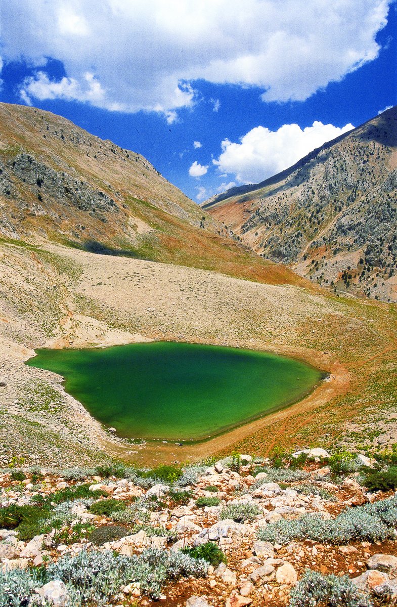
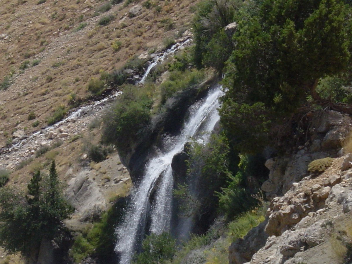
Gömbe
An ideal place to escape the summer heat is Gombe, 60km north of Kas, in the cool plateau of the Akdag mountain range. The forest-covered route with pine and cedar trees almost conceal the village, famous for its cools springs and apple orchards.Akdag is the highest mountain in this range, reaching 3024m, and the villages of Yesilgol and Ucarsu are good for trekking. The herbs which grow in this area are used in local cooking and there are several restaurants in the main square. There is afamous festival of the local Tahtacis in June, and a farmers’ fair in late August.